


You may also like
-
Map of Iceland Poster
Kongelige Danske Søkort-Arkiv · 1871 · Detailed nautical vintage print mapping Iceland with soundings and coastal place names
Poster from €9 · Framed from €16
Regular price From €6,00Regular price -
Europe geology map Poster
John George Bartholomew · 1942 · Detailed poster of Europe’s geology with layered colors and fine cartographic linework
Poster from €9 · Framed from €16
Regular price From €6,00Regular price -
Gazetteer of the British Isles Poster
John Bartholomew · 1887 · Detailed British Isles vintage print balancing crisp labels with an atlas-like cartographic layout
Poster from €9 · Framed from €16
Regular price From €6,00Regular price -
Geological map of the world Poster
James Reynolds · 1850 · Detailed world geology vintage print with color-coded strata and neat Victorian labels
Poster from €9 · Framed from €16
Regular price From €6,00Regular price


-

"Very nice Posters. The quality is amazing and we received it very quickly !"
-

"A shop to visit absolutely. Huge selection of posters. We spent more than an hour there !"
-

"Perfect to find gift. Price are very good. An they can frame and pack it on site"


About the Artist
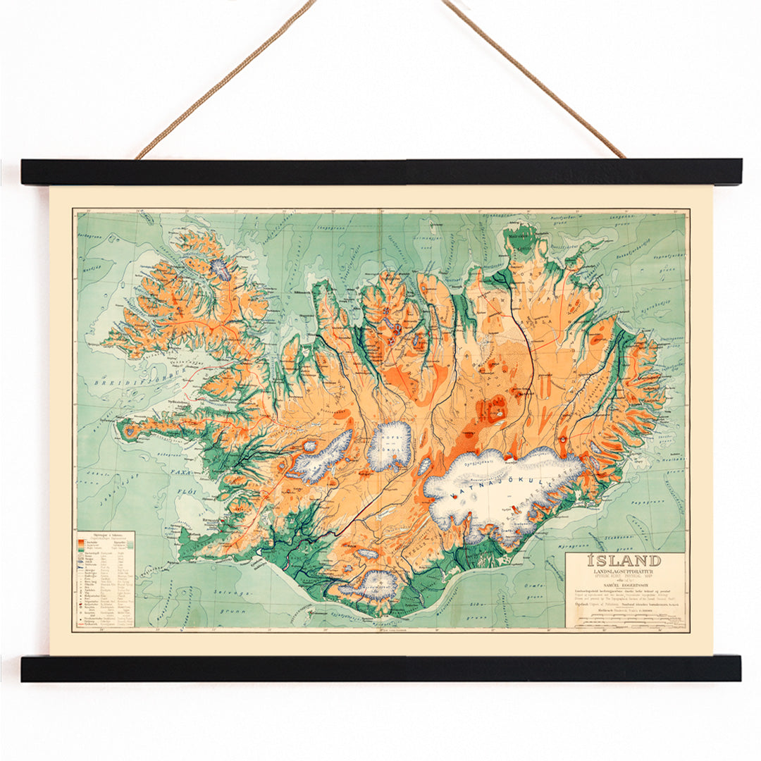
Samuel Eggertsson was an Icelandic cartographer active at the end of the nineteenth century, a period when printed maps became vital for governance, education, and exploration. His work reflects the broader European tradition of late Victorian cartography, where clarity, precision, and elegant lettering were highly valued. Eggertsson contributed to the visual documentation of Iceland at a time when national identity and geographic understanding were rapidly evolving.
This map stands as a historical artifact from an era when Iceland was being systematically charted and its regions defined on paper. For collectors and enthusiasts, it offers a glimpse into the ambitions of nineteenth-century mapmakers and the growing importance of geographic literacy in daily life.
The Artwork
Created in 1890, this political map of Iceland transforms the island from a distant North Atlantic landmass into a clearly organized territory, divided into regions and jurisdictions. Such maps were essential tools in classrooms, offices, and libraries, helping people visualize and comprehend the administrative structure of the country. Today, it serves as a testament to the era's drive to make remote places accessible and understandable through cartography.
As part of a curated wall display, this piece complements other geographic works in the maps collection and can be paired with related themes from the landscape collection for a cohesive visual narrative.
Style & Characteristics
The map features Iceland centrally positioned, surrounded by pale blue waters, with crisp black linework and densely labeled towns and regions. Distinct color washes—primarily green, orange, and red—define the different jurisdictions, set against a light, archival background. The overall design is orderly and restrained, characteristic of nineteenth-century atlas production, balancing decorative appeal with functional clarity.
This vintage print exudes a calm, scholarly atmosphere, making it especially appealing to those who appreciate historical documents and clean, organized visuals. The careful hand-tinting and precise typography lend it both authenticity and charm.
In Interior Design
This Iceland map vintage print is well-suited for home offices, libraries, hallways, or living rooms, particularly in Scandinavian, minimalist, or coastal interiors. Its subtle palette pairs beautifully with pale woods, stone neutrals, and textured textiles, while the colored regions can inspire accent choices in sage, terracotta, or rust.
For a harmonious look, consider combining it with pieces from the green wall art or orange posters collections, and finish with understated selections from the frames collection. It also appeals to travelers, historians, and admirers of Nordic design.