


You may also like
-
Eastern division of Paris Poster
James Shury · 1834 · Finely engraved Paris map poster with dense street detail and crisp black linework
Poster from €9 · Framed from €16
Regular price From €6,00Regular price -
Whitbread new plan of London Poster
J. Whitbread · 1853 · Detailed London map poster with Thames curves and highlighted streets on warm beige
Poster from €9 · Framed from €16
Regular price From €6,00Regular price -
New York Minimalist Map Poster
MORYARTY · 2018 · Minimal New York map poster in crisp blue with white street-grid geometry
Poster from €9 · Framed from €16
Regular price From €6,00Regular price -
Plano de Barcelona 1870 Poster
Unknown artist · 1870 · Intricate Barcelona city plan vintage print with crisp street grid on warm beige
Poster from €9 · Framed from €16
Regular price From €6,00Regular price


-

"Very nice Posters. The quality is amazing and we received it very quickly !"
-

"A shop to visit absolutely. Huge selection of posters. We spent more than an hour there !"
-

"Perfect to find gift. Price are very good. An they can frame and pack it on site"


About the Artist
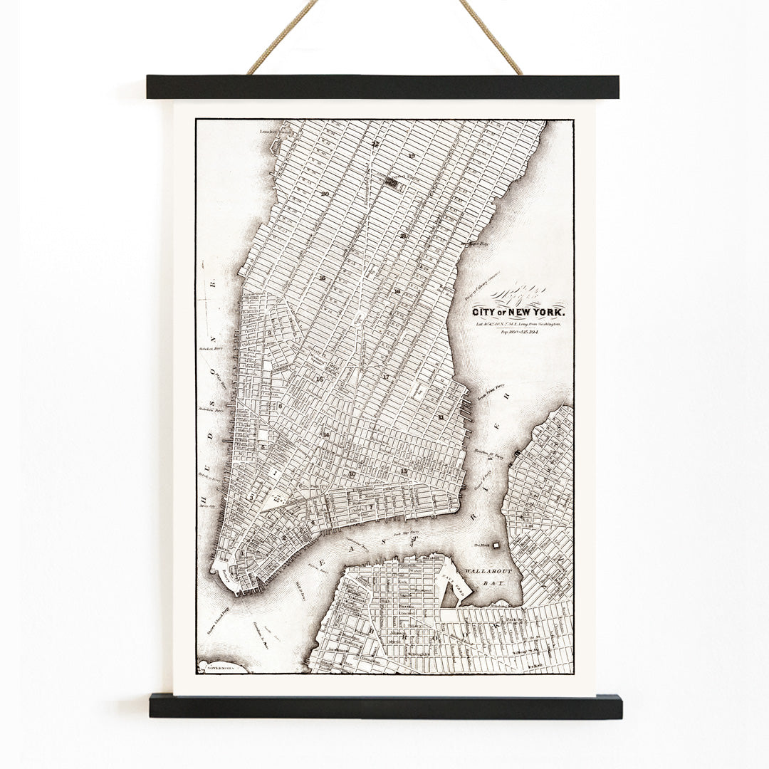
Created by an anonymous artist, this 1850 map reflects the golden age of nineteenth-century cartography, when rapidly expanding cities like New York were meticulously documented by publishers and surveyors. In a time before digital navigation, such maps were essential tools for travelers, merchants, and civic leaders, serving both practical and symbolic roles in society.
Beyond its original function, this piece now stands as a historical artifact—an early New York City map that bridges the past and present for those interested in urban history. For more cartographic works, see our map prints collection.
The Artwork
This map of New York City was produced during a period of significant urban transformation, as Manhattan’s street grid was taking shape and the city’s boundaries were rapidly extending. It documents a moment when infrastructure, neighborhoods, and waterfronts were evolving to accommodate waves of new residents and economic activity.
Originally, this vintage print would have helped users navigate the city’s complex layout, providing a sense of order amid expansion. Today, it offers a tangible connection to New York’s layered history, making urban development visible and accessible. For those interested in monochrome cityscapes, explore our black and white posters.
Style & Characteristics
The map features precise black linework on softly aged, beige-toned paper, emphasizing clarity and legibility. Streets, blocks, and districts are tightly labeled, forming a dense geometric grid that contrasts with the open, undulating outlines of the surrounding rivers and harbor.
The overall impression is archival and refined, with a restrained palette that highlights the map’s historical character. This piece exemplifies classic cartographic design, making it ideal for pairing with other beige tone prints or minimalist decor for a cohesive look.
In Interior Design
This vintage map print is well suited to studies, libraries, or living rooms where historical detail and conversation pieces are appreciated. Its intricate composition invites close inspection, rewarding viewers with discoveries of street names and waterfront contours.
The neutral tones and disciplined design allow it to complement both modern and traditional interiors, working especially well with wood, leather, and matte finishes. It can serve as a focal point in a travel-themed gallery wall or add a sense of heritage to contemporary spaces.